Description and data access to enhanced Alongtrack MGDR data – available over the oceans and continents.
Data access
- Access to the Jason-1, Jason-2 and Envisat online data catalogue
- Access to the Cryosat-2 data request form
- Access to the GFO and Topex data request form
On-line altimetry data information
- Altimetric parameters within the Geophysical Data Records (GDR) + CTOH up-to-date corrections:
- Start and end date for each cycle, handbooks, …
| Alongtrack data with up-to-date corrections over the oceans and continents added by the CTOH |
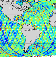
We maintain on-line Merged Geophysical Data Records (MGDRs) over the oceans and continents for surface topography studies (e.g. sea level, river levels, polar ice cap topography) for the Topex/Poseidon, Jason-1, GFO and ENVISAT missions.
The MGDRs have a data point every 1 second (about 7 km) alongtrack and also at high frequency for the raw data (10hz, 18hz or 20hz according to the mission). At each data point, we store the altimetric topographic height, as well as all of the atmospheric and geophysical corrections that are necessary to obtain accurate surface topography estimates (instrument corrections, orbits, tides, atmospheric propagation delays, etc.). We store on-line all of the MGDR data distributed by the operational centres.
In addition, the CTOH MGDRs include additional up-to-date corrections.
Standard extractions provide the corrected surface topography using the most up-to-date CTOH corrections.Non-standard extractions allows the user to choose “à la carte” his/her own combination of data and corrections. Alongtrack extractions can be made for each mission : Topex/Poseidon , Jason-1 , GFO, ENVISAT and Jason-2 data .