ERS-2 is a spatial altimetric mission operating between 1995 and 2011 but providing data globally until 2003. The principle of radar altimetry is the following: the altimeter emits a radar pulse and measures the two-way travel-time from the satellite to the surface. The distance between the satellite and the Earth surface – the altimeter range – is thus derived with a precision of a few centimeters. The satellite altitude referred to an ellipsoid is also accurately known from orbitography modeling. Taking into account propagation delays due to interactions of electromagnetic wave in the atmosphere and geophysical corrections, the height of the reflecting surface with reference to an ellipsoid (Chelton et al., 2001; Frappart et al., 2017).
The Center for the Topography of Oceans and the Hydrosphere (CTOH) has reprocessed the original ERS-2 waveforms (WAP data) with a new implementation of the ICE-2 retracker algorithm. The new ERS-2 product includes new altimetric corrections that make it compatible and homogenous with the ENVISAT (v2.1) mission, and is tailored for continental surfaces, but with global coverage; this product provides a baseline for ERS-2/ENVISATv2.1 continuity and long-term altimetry data analysis (1995-2010).
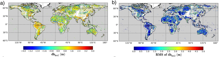
The ERS altimetry data are historically distributed at level 2 only for open ocean applications. CTOH has created a new version of the LEGOS ERS altimetry processing chain (Legrésy and Rémy, 1997), and has conducted a reanalysis of the ERS-2 altimetry waveforms using WAP data kindly provided by ESA. This reprocessing of the ERS-2 waveforms (WAP data) included a new implementation of the ICE-2 retracker algorithm, with additional altimetric corrections to make ERS-2 data compatible and homogenous with the ENVISAT mission for continuity and long-term altimetry data analysis over land and ice sheets.
This processing contains the ICE-1 and ICE-2 retracking parameters and updated corrections. We have used GFZ precise orbits (Rudenko et al., 2014) for the period May 1995 – July 2003. We also computed a new dry troposphere correction with ERA-INTERIM fields valid over all surfaces (Blarel and Legresy, 2013) and a new Doppler correction accounting for the range rate (Blarel and Legresy, 2012). For each waveform parameter (range, backscatter, leading edge width and trailing edge slope) we computed empirical corrections to make them comparable to ENVISAT-v2.1. We produce a dataset providing continuity between the ERS-2 and ENVISAT missions (Blarel et al., 2015).
While this ERS-2 product focuses on continental surfaces, an alternative REAPER ERS-2 product exists, tailored for ocean applications (ESA Reaper, 2015); they are hence complementary.
ERS-2 data are made available in netcdf format in files containing data for one track and one cycle. They are available from May 1995 to June 2003 between 81.46°N and 81.46°S of latitude on this web page: https://www.legos.omp.eu/ctoh/catalogue/?uuid=c5815d21-cebc-4ec3-8a58-03cde0310755.
The along-track spatial resolution is 350 m for high frequency data (20 Hz) and 7 km for low frequency data (1 Hz). The list of available parameters, including geographical locations, time of acquisition, all the variables necessary to compute the altimeter height, outputs from several geoid models and altimetry backscattering coefficients, is provided in the user handbook. These data can be visualized and processed to obtain time series of water levels with Multi-mission Altimetry Processing Software (MAPS) (Frappart et al., 2015). Locations and number of ERS-2 altimetry tracks is available here: https://www.aviso.altimetry.fr/fileadmin/documents/data/tools/Visu_EN_Tracks_GE_OldOrbit.kmz
References:
- “Dataset: Altimetric data of the ERS-2 mission”. OMP-INSU-UPS-IRD. doi:10.6096/CTOH_ERS-2_2015_01.
- Frappart F., Legresy B., Niño F., Blarel F., Fuller N., Fleury S., Birol F., Calmant S. (2016). An ERS-2 Altimetry Reprocessing Compatible with ENVISAT for Long- Term Land and Ice Sheets Studies. Remote Sensing of Environment, 184, 558–81. https://doi.org/10.1016/j.rse.2016.07.037.
- Manuel de l’utilisateur/User handbook
Other references:
- Blarel, F., B. Legresy. 2013. “Investigations On The Envisat Ra2 Tropospheric Correction”. ESA Living Planet. Edinburgh, United Kingdom.
- Blarel, Fabien, et Benoît Legresy. 2012. “Investigations On The Envisat Ra2 Doppler Slope Correction For Ice Sheets”. ESA-CNES symposium on altimetry Venice.
- Chelton, D. B.; Ries, J. C.; Haines, B. J.; Fu, L. L.; Callahan, P. S. Satellite Altimetry. In Satellite Altimetry and the Earth Sciences: A Handbook of Techniques and Applications; Fu, L. L., Cazenave, A., Eds.; Academic Press: San Diego, 2001; pp 1–131.
- Frappart F., Papa F., Marieu V., Malbéteau Y., Jordy F., Calmant S., Durand F., Bala S. (2015). Preliminary assessment of SARAL/AltiKa observations over the Ganges-Brahmaputra and Irrawaddy Rivers, Marine Geodesy, 38(S1), 568-580, doi:10.1080/01490419.2014.990591.
- Frappart, F.; Blumstein, D.; Cazenave, A.; Ramillien, G.; Birol, F.; Morrow, R.; Rémy, F. Satellite Altimetry: Principles and Applications in Earth Sciences. In Wiley Encyclopedia of Electrical and Electronics Engineering; John Wiley & Sons, Inc: Hoboken, NJ, USA, 2017; pp 1–25.
- Legrésy, B., Rémy, F, 1997. Surface characteristics of the Antarctic ice sheet and altimetric observations. Journal of Glaciology, 43(144), 197-206.
- Rudenko, Sergei, Denise Dettmering, Saskia Esselborn, Tilo Schöne, Christoph Förste, Jean-Michel Lemoine, Michaël Ablain, David Alexandre, et Karl-Hans Neumayer. 2014. “Influence of Time Variable Geopotential Models on Precise Orbits of Altimetry Satellites, Global and Regional Mean Sea Level Trends”. Advances in Space Research 54 (1): 92 118. doi:10.1016/j.asr.2014.03.010.
- ESA Reaper product: https://earth.esa.int/documents/10174/1511090/Reaper-Product-Handbook-3.1.pdf